Анализ эрозии почв на основе RUSLE и оценка мер по борьбе с эрозией в Кабульском бассейне.

Самиулла Патьял

Инженерный факультет гидротехнических сооружений, Кабульский политехнический университет,   г. Кабул, Афганистан

E-mail: spatyal65@gmail.com

https://doi.org/10.29258/CAJWR/2022-R1.v8-1/143-159.eng

Аннотация

Освоение и охрана водных и земельных ресурсов Кабульского речного бассейна имеют решающее значение для обеспечения его устойчивого социально-экономического и экологического развития.  Поскольку сток с территории бассейна пересекает международные границы и попадает на территорию бассейна р. Инд, странам верховий и низовий чрезвычайно важно тщательно планировать меры по эксплуатации соответствующих ресурсов и управлению ими.  Ввиду особенностей рельефа, почвенных и климатических условий, а также обезлесения в недавнем прошлом в бассейне р. Кабул наблюдается значительная водная эрозия почв, что указывает на необходимость анализа ее специфики и принятия надлежащих мер контроля.  Настоящее исследование было проведено с применением комбинации модели на основе пересмотренного универсального уравнения потерь почвы ввиду эрозии (RevisedUniversalSoilLossEquation, RUSLE) и ГИС-методов с целью анализа темпов суммарной потери почвы и ее пространственного распределения внутри целевого бассейна.  Результаты исследования указывают на среднегодовые потери почвы в размере 15,1 т/га, т.е. существенную эрозию почв. Что же касается пространственного распределения потерь, то по данным настоящего исследования до 99% их среднегодового объема относятся к категории допустимых (0-5 т/га).  Принимая во внимание темпы потери почв, местную топографию и возможности вовлечения местных общин, авторы рекомендуют провести дальнейший подробный диагностический анализ ситуации для сбора данных и поддержки последующих мер борьбы с эрозией, таких как профилактика обезлесения, строительство небольших речных плотин, террасирование, тренчинг в холмистых зонах, восстановление растительного покрова на открытых и луговых угодьях и сбор дождевой воды.

Available in English

Download the article (eng)

Для цитирования: Patyal, S. (2022). RUSLE-based soil erosion assessment and erosion control evaluation in the Kabul Watershed. Central Asian Journal of Water Research, 8(1), 143–159. https://doi.org/10.29258/CAJWR/2022-R1.v8-1/143-159.eng

Список литературы

Benavidez, R., Jackson, B., Maxwell, D. & Norton, K. (2018).  A review of the (Revised) Universal Soil Loss Equation ((R)USLE): With a view to increasing its global applicability and improving soil loss estimates.  Hydrology and Earth System Sciences, 22 (11), 6059-6086 (https://doi.org/10.5194/ hess-22-6059-2018)

FAO (2012).  The Islamic Republic of Iran.  In Government of the Islamic Republic of Afghanistan (https://doi.org/10.4324/9780203847459)

Folliott, P., Brooks, K., Neary, D., Roberto, T. & Chevesich, P. (2013).  Soil erosion and sediment production on watershed landscapes: processes and control.  In Documento Técnico del PHI-LAC 32 (https://www.fs.usda.gov/treesearch/pubs/46794)

Gabriels, D., Cornelis, W.M. & Schiettecatte, W. (1998).  Water Harvesting and Water-Saving techniquesV, 1-10

Gis, C.E. & David, R. (2014).  Soil Erosion Assessment using GIS and Revised Universal Soil Loss Equation ( RUSLE ).  List of Figures

Hickey, R. (2000).  Slope angle and slope length solutions for GIS.  Cartography, 29 (1), 1-8 (https://doi.org/10.1080/00690805.2000.9714334)

Islamic, T., Of, S. & Irrigation, M. O. F. (2004).  A strategic policy framework for the water sector : final draft / Transitional Islamic State of Afghanistan, Ministry of Irrigation, Water Resources Environment (MIWRE).  A Strategic Policy Framework for the Water Sector: Final Draft / Transitional Islamic State of Afghanistan, Ministry of Irrigation, Water Resources Environment (MIWRE), May (https://doi.org/10.29171/azu_acku_pamphlet_td313_a3_s775_2004)

Julien, P.Y. (2004).  EROSION AND SEDIMENTATION.  2nd Ed., Erosion and Sedimentation, 2nd Ed. Pierre Y. Julien Frontmatter More information, 1 (www.cambridge.org)

Jung, C.-G., Jang, W.-J. & Kim, S. (2017).  Estimation of 1 km Grid-based WATEM/SEDEM Sediment Transport Capacity Using 1 Minute Rainfall Data and SWAT Semi-distributed Sediment Transport Capacity Results for Han River Basin of South Korea.  Hydrology and Earth System Sciences Discussions, January, 1-21 (https://doi.org/10.5194/hess-2016-649)

Khassaf, S. & Al Rammahi, A. (2018).  Estimation of Slope Length Factor (L) and Slope Steepness Factor (S) of Rusle Equation in the Euphrates River Watershed By Gis Modeling.  Kufa Journal of Engineering, 9 (3), 81-91 (https://doi.org/10.30572/2018/kje/090307)

Khassaf, S.I., Hussein, A., Al, J., Al-Abadi, A.M.A., Ghalib, H.B., Al-Qurnawi, W.S., Hussein, M.H. & Keya, D.R. (2018a).  Estimation of Soil Erosion Risk of the Euphrates River Watershed Using RUSLE Model, Remote Sensing and GIS Techniques.  Polytechnic Journal, 8 (1), 8-21 (https://doi.org/10.25675/10217/201096)

Khassaf, S.I., Hussein, A., Al, J., Al-Abadi, A.M.A., Ghalib, H.B., Al-Qurnawi, W.S., Hussein, M.H. & Keya, D.R. (2018b).  Estimation of Soil Erosion Risk of the Euphrates River Watershed Using RUSLE Model , Remote Sensing and GIS Techniques.  Polytechnic Journal, 8 (1), 8-21

Kouli, M., Soupios, P. & Vallianatos, F. (2009).  Soil erosion prediction using the Revised Universal Soil Loss Equation (RUSLE) in a GIS framework, Chania, Northwestern Crete, Greece. Environmental Geology, 57 (3), 483-497 (https://doi.org/10.1007/s00254-008-1318-9)

Kuenstler, W. (1998).  C factor: Cover-Management Author: In Guidelines for the Use of the Revised Universal Soil Loss Equation (RUSLE) Version 1.06 on Mined Lands, Construction Sites, and Reclaimed Lands Terrence, 148

Lee, J.P. (2007). Estimation of Rainfall-runoff Erosivity for Individual Storm Events.  Journal of Hydrology, 160 (537), 2007

Manual, R., Flood, F., Management, R., & Measures, S. (2012).  Chapter 5: Physical Methods for Slope Stabilization and Erosion Control, 30-59

Molla, T. & Sisheber, B. (2017).  Estimating soil erosion risk and evaluating erosion control measures for soil conservation planning at Koga watershed in the highlands of Ethiopia.  Solid Earth, 8 (1), 13-25 (https://doi.org/10.5194/se-8-13-2017)

Panagos, P., Borrelli, P., Meusburger, K., van der Zanden, E.H., Poesen, J. & Alewell, C. (2015). Modelling the effect of support practices (P-factor) on the reduction of soil erosion by water at European scale.  Environmental Science and Policy, 51 (April), 23-34 (https://doi.org/10.1016/j.envsci.2015.03.012)

Sahar, A.S. (2013).  Shukran_Thesis.pdf  [Colorado State University Fort] (https://www.scribd.com/ document/362172198/Shukran-Thesis)

UNEP (2004).  Afghanistan’s Environmental Recovery.  A Post-Conflict Plan for People and their Natural Resources

FAO (2012).  Watershed Atlas of Afghanistan, 1-184.

пересмотренное универсальное уравнение потерь почвы ввиду эрозии (RUSLE), террасирование, траншеи (тренчинг), цифровая модель рельефа (ЦМР)

RUSLE-based soil erosion assessment and erosion control evaluation in the Kabul Watershed

Samiullah Patyal

Hydraulic Structures Engineering Department, Kabul Polytechnic University, Kabul, Afghanistan

E-mail: spatyal65@gmail.com

https://doi.org/10.29258/CAJWR/2022-R1.v8-1/143-159.eng

Research article

Abstract


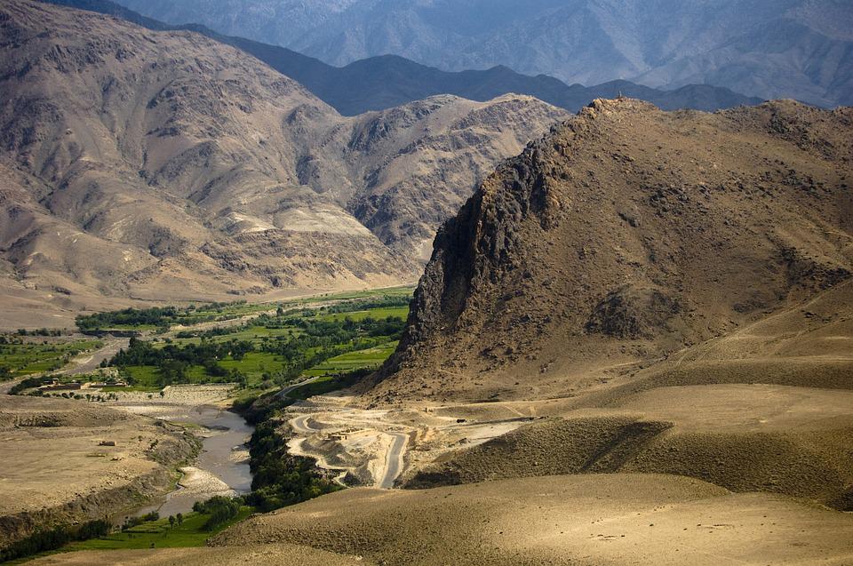
The development and conservation of water and soil in the Kabul River Basin are critical for ensuring its sustainable economic, social, and environmental progress. Since the watershed drains across the international borders into the Indus River Basin, it is key for both up- and downstream countries to thoroughly plan their resource development and management. Due to relief, soil and climatic conditions, as well as the recent deforestation the Kabul River Basin has been witnessing significant soil erosion by water, indicating the need for analyzing its specifics and deploying proper control measures. This study was carried out using the combination of the Revised Universal Soil Loss Equation (RUSLE) Model and GIS techniques to investigate the gross soil loss rates and their spatial distribution inside the target basin. Thus, the annual average soil loss rate was estimated at 15.1 tons/ha/year, pointing to severe local soil erosion. As to its spatial distribution, according to the study up to 99% of mean annual soil loss rates fell within the tolerable (0-5 tons/acre/year) category. Considering the soil loss rates, local topography, and community-based participatory approaches, the authors recommend conducting a further detailed diagnostic analysis to inform and support subsequent control measures such as deforestation prevention, construction of small check dams, terracing, trenching in hilly areas, revegetation (reforestation) of open- and grasslands, and rainwater harvesting.

Available in English

Download the article (eng)

For citation: Patyal, S. (2022). RUSLE-based soil erosion assessment and erosion control evaluation in the Kabul Watershed. Central Asian Journal of Water Research, 8(1), 143–159. https://doi.org/10.29258/CAJWR/2022-R1.v8-1/143-159.eng

References

Benavidez, R., Jackson, B., Maxwell, D. & Norton, K. (2018).  A review of the (Revised) Universal Soil Loss Equation ((R)USLE): With a view to increasing its global applicability and improving soil loss estimates.  Hydrology and Earth System Sciences, 22 (11), 6059-6086 (https://doi.org/10.5194/ hess-22-6059-2018)

FAO (2012).  The Islamic Republic of Iran.  In Government of the Islamic Republic of Afghanistan (https://doi.org/10.4324/9780203847459)

Folliott, P., Brooks, K., Neary, D., Roberto, T. & Chevesich, P. (2013).  Soil erosion and sediment production on watershed landscapes: processes and control.  In Documento Técnico del PHI-LAC 32 (https://www.fs.usda.gov/treesearch/pubs/46794)

Gabriels, D., Cornelis, W.M. & Schiettecatte, W. (1998).  Water Harvesting and Water-Saving techniquesV, 1-10

Gis, C.E. & David, R. (2014).  Soil Erosion Assessment using GIS and Revised Universal Soil Loss Equation ( RUSLE ).  List of Figures

Hickey, R. (2000).  Slope angle and slope length solutions for GIS.  Cartography, 29 (1), 1-8 (https://doi.org/10.1080/00690805.2000.9714334)

Islamic, T., Of, S. & Irrigation, M. O. F. (2004).  A strategic policy framework for the water sector : final draft / Transitional Islamic State of Afghanistan, Ministry of Irrigation, Water Resources Environment (MIWRE).  A Strategic Policy Framework for the Water Sector: Final Draft / Transitional Islamic State of Afghanistan, Ministry of Irrigation, Water Resources Environment (MIWRE), May (https://doi.org/10.29171/azu_acku_pamphlet_td313_a3_s775_2004)

Julien, P.Y. (2004).  EROSION AND SEDIMENTATION.  2nd Ed., Erosion and Sedimentation, 2nd Ed. Pierre Y. Julien Frontmatter More information, 1 (www.cambridge.org)

Jung, C.-G., Jang, W.-J. & Kim, S. (2017).  Estimation of 1 km Grid-based WATEM/SEDEM Sediment Transport Capacity Using 1 Minute Rainfall Data and SWAT Semi-distributed Sediment Transport Capacity Results for Han River Basin of South Korea.  Hydrology and Earth System Sciences Discussions, January, 1-21 (https://doi.org/10.5194/hess-2016-649)

Khassaf, S. & Al Rammahi, A. (2018).  Estimation of Slope Length Factor (L) and Slope Steepness Factor (S) of Rusle Equation in the Euphrates River Watershed By Gis Modeling.  Kufa Journal of Engineering, 9 (3), 81-91 (https://doi.org/10.30572/2018/kje/090307)

Khassaf, S.I., Hussein, A., Al, J., Al-Abadi, A.M.A., Ghalib, H.B., Al-Qurnawi, W.S., Hussein, M.H. & Keya, D.R. (2018a).  Estimation of Soil Erosion Risk of the Euphrates River Watershed Using RUSLE Model, Remote Sensing and GIS Techniques.  Polytechnic Journal, 8 (1), 8-21 (https://doi.org/10.25675/10217/201096)

Khassaf, S.I., Hussein, A., Al, J., Al-Abadi, A.M.A., Ghalib, H.B., Al-Qurnawi, W.S., Hussein, M.H. & Keya, D.R. (2018b).  Estimation of Soil Erosion Risk of the Euphrates River Watershed Using RUSLE Model , Remote Sensing and GIS Techniques.  Polytechnic Journal, 8 (1), 8-21

Kouli, M., Soupios, P. & Vallianatos, F. (2009).  Soil erosion prediction using the Revised Universal Soil Loss Equation (RUSLE) in a GIS framework, Chania, Northwestern Crete, Greece. Environmental Geology, 57 (3), 483-497 (https://doi.org/10.1007/s00254-008-1318-9)

Kuenstler, W. (1998).  C factor: Cover-Management Author: In Guidelines for the Use of the Revised Universal Soil Loss Equation (RUSLE) Version 1.06 on Mined Lands, Construction Sites, and Reclaimed Lands Terrence, 148

Lee, J.P. (2007). Estimation of Rainfall-runoff Erosivity for Individual Storm Events.  Journal of Hydrology, 160 (537), 2007

Manual, R., Flood, F., Management, R., & Measures, S. (2012).  Chapter 5: Physical Methods for Slope Stabilization and Erosion Control, 30-59

Molla, T. & Sisheber, B. (2017).  Estimating soil erosion risk and evaluating erosion control measures for soil conservation planning at Koga watershed in the highlands of Ethiopia.  Solid Earth, 8 (1), 13-25 (https://doi.org/10.5194/se-8-13-2017)

Panagos, P., Borrelli, P., Meusburger, K., van der Zanden, E.H., Poesen, J. & Alewell, C. (2015). Modelling the effect of support practices (P-factor) on the reduction of soil erosion by water at European scale.  Environmental Science and Policy, 51 (April), 23-34 (https://doi.org/10.1016/j.envsci.2015.03.012)

Sahar, A.S. (2013).  Shukran_Thesis.pdf  [Colorado State University Fort] (https://www.scribd.com/ document/362172198/Shukran-Thesis)

UNEP (2004).  Afghanistan’s Environmental Recovery.  A Post-Conflict Plan for People and their Natural Resources

FAO (2012).  Watershed Atlas of Afghanistan, 1-184.

Digital Elevation Model (DEM), Revised Universal Soil Loss Equation (RUSLE), terracing, trenches (trenching), watershed (basin)