Overview of modelling techniques for Geo Hazard Risk Assessment
Zhanay Sagintayev
School of Engineering, Nazarbayev University, Astana, Kazakhstan (zhanay.sagintayev@nu.edu.kz)
Serikzhan Atanov
Kazakh-German University, Almaty, Kazakhstan
Abror Gafurov
GFZ German Research Centre for Geosciences, Potsdam, Germany
Scientific Article
Abstract
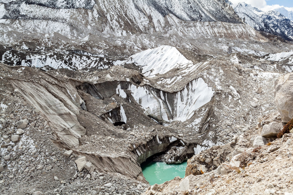
The occurrence of disasters both natural and man-made is inescapable. For this reason, the key to successful disaster resilience is preparation. Climatic and Anthropogenic distortions and the increasing population have impacted the environment and increased the probabilities of disaster events in the Central Asia region. Water resources in Central Asia are generated at high mountains with snow and glacier melt dominating the flow regime. Increasing temperatures at higher elevations will have an impact on the snow and glacier melting process and this will change the flow regime of Central Asian rivers. A combination of different modeling techniques, including regional climate monitoring, hydrological, hydro-geological, river hydraulics, geotechnical, debris flows, landslides, Artificial Neural Networks (ANN) modeling tools are helpful for prediction analysis and disaster event preparation activities. Some these modeling techniques are reviewed in this article.
Download the articleHow to cite: Sagintayev, Z. Atanaov S. Gafurov A, (2017). Overview of modelling techniques for Geo Hazard Risk Assessment. Central Asian Journal of Water Research, 3(1), 35–42.
References
- DFO, 2017, Dartmouth Flood Observatory (DFO Flood Events), http://floodobservatory.colorado.edu/Events/2017Kazakhstan4465/2017Kazakhstan44 65.html
- NASA, 2017, Earth Observatory NASA, Natural Hazards Central Asia, https://earthobservatory.nasa.gov/NaturalHazards/view.php?id=17369
- Schwarz, E., 2006, “A Needless Toll of Natural Disasters”, UN Secretary General‟s Deputy Special Envoy, Op-Ed. The Boston Globe. boston.com/news/globe/editorial_opinion/oped/articles/2006/03/23/
- Farinotti, D., Longuevergne, L., Moholdt, G., Duethmann, D., Mölg, T., Bolch, T., Vorogushyn, S. and Güntner, A., 2015. Substantial glacier mass loss in the Tien Shan over the past 50 years, Nature Geoscience, 8, 716–722, 2015, doi:10.1038/ngeo2513
- IPCC, 2012, Managing the Risks of Extreme Events and Disasters to Advance Climate Change Adaptation. A Special Report of Working Groups I and II of the Intergovernmental Panel on Climate Change. Cambridge University Press, Cambridge, UK, and New York, NY, USA, 582 pp.
- IPCC, 2014, Climate Change 2014: Impact, Adaptation and Vulnerability. Summary for policy makers. Working Group II of the Intergovernmental Panel on Climate Change, AR5
- Ravanel L. and Deline P. 2011. Climate influence on rockfalls in High-Alpine steep rock walls: The north side of the Aiguilles de Chamonix (Mont Blanc massif) since the end of the „Little Ice Age‟. The Holocene, 21(2):357- 365.
- Box, G. E. P., 1976, “Science and Statistics”, Journal of the American Statistical Association, 71(356): 791–799, doi:10.1080/01621459.1976.10480949
- DDC IPCC, 2017, Intergovernmental Panel on Climate Change (IPCC), http://www.ipcc-data.org/
- Gafurov, A., Goetzinger, J. and Bàrdossy, A., 2006. Hydrological modeling for meso scale catchments using globally available data, Hydrology and Earth System Sciences Discussion, 3(4): 2209-2242.
- Gafurov, A., Lüdtke, S., Unger-Shayesteh, K., Vorogushyn, S., Schöne, T., Schmidt, S., Kalashnikova, O., and Merz, B. 2016, MODSNOW-Tool: an operational tool for daily snow cover monitoring using MODIS data. Environmental Earth Sciences 75: 1078, DOI: 10.1007/s12665-016-5869-x
- PRECIS, 2017, PRECIS: a regional climate modelling system, http://www.metoffice.gov.uk/research/applied/international-development/precis
- Güenter, A. and Bonstert. A., 2004. Representation of landscape variability and lateral redistribution processes for a large-scale hydrological modeling in semi-arid areas. Journal of Hydrology 297 (1-4):136-161. DOI: 10.1016/j.jhydrol.2004.04.008
- Gafurov, A., Kriegel, D., Vorogushyn, S. and Merz, B. 2013. Evaluation of remotely sensed snow cover product in Central Asia. Hydrology Research 44(3), 506-522. DOI: 10.2166/nh.2012.094
- Sagintayev, Z, Sultan, M., Khan, S. D., Khan, A. S., Mahmood, K., Yan,E., Milewski, A., and Marsala, P., 2011, Remote Sensing Contributions to Hydrologic Modeling in Arid and Inaccessible Watersheds, Pishin Lora Basin, Pakistan. Journal of Hydrological Processes 26(1), DOI: 10.1002/hyp.8114/full
- Sagintayev, J., Z. Yerikuly, S. Zhaparkhanov, V. Panichkin, O. Miroshnichenko, and S. Mashtayeva. 2015. Groundwater inflow modeling for a Kazakhstan copper ore deposit, Journal of Environmental Hydrology, 1 (23) Paper 9.
- Sagintayev, J., Salybekova V., Kalitov D., Zavaley V., and Rakhimov T. 2016. Numerical Modeling of the Intensification Processes of Groundwater Treatment for Hexavalent Chromium Using In Situ Technology, Journal of Environmental Hydrology, 24 (Paper 4: 1 – 13).
- DHI, 2017, DHI MIKE is the global organization dedicated to solving challenges in water environments worldwide, https://www.mikepoweredbydhi.com/
- Boon CW., Houlsby GT. and Utili S. 2012. A new algorithm for contact detection between convex polygonal and polyhedral particles in the discrete element method. Computers and Geotechnics, 44: 73-82. DOI: 10.1016/j.compgeo.2012.03.012
- Boon CW., Houlsby GT. and Utili S. 2013. A new contact detection algorithm for three dimensional non- spherical particles. Powder Technology,248: 94-102. http://dx.doi.org/10.1016/j.powtec.2012.12.040
- Sloan, S. W., and Abbo, A. J. 1999. Biot consolidation analysis with automatic time stepping and error control Part 1: theory and implementation. International Journal for Numerical and Analytical Methods in Geomechanics, 23(6): 467-492. DOI: 10.1002/(SICI)1096-9853(199905)23:6<467
- Tamagnini, C., Castellanza, R., and Nova, R. 2002. A generalized backward Euler algorithm for the numerical integration of an isotropic hardening elastoplastic model for mechanical and chemical degradation of bonded geomaterials. International Journal for Numerical and Analytical Methods in Geomechanics, 26(10): 963-1004. DOI: 10.1002/nag.231
- Collin F., Laloui L., and Charlier R. (2005). Unified approach of coupled constitutive laws. Revue Européenne de Génie Civil, 9, 713-723.
- Kim J., Moridis G., Yang D. and Rutqvist J., 2012, Numerical studies on two-way coupled fluid flow and geomechanics in hydrate deposits. Society of Petroleum Engineers Journal, 17(2): 485-501.
- Sibille, L., Donzé, F. V., Nicot, F., Chareyre, B., & Darve, F. 2008. From bifurcation to failure in a granular material: a DEM analysis. Acta Geotechnica, 3(1):15-24.
- Andrade JE., Avila CF., Hall SA., Lenoir N., and Viggiani G., 2011, Multiscale modeling and characterization of granular matter: from grain kinematics to continuum mechanics. Journal of the Mechanics and Physics of Solids, 59(2), 237-250 http://doi.org/10.1016/j.jmps.2010.10.009
- Gatmiri B., and Arson C., 2008. Theta-Stock, a powerful tool for thermohydromechanical behavior and damage modelling of unsaturated porous media. Computers and Geotechnics, 35(6): 890-915. DOI: 10.1016/j.compgeo.2008.08.008
- Haykin, S. O. 2009. Neural Networks and Learning Machines 3rd Ed. NY: NYL Pearson Prentice Hall. https://cours.etsmtl.ca/sys843/REFS/Books/ebook_Haykin09.pdf
- Elsafi, S., 2014, Artificial Neural Networks (ANNs) for flood forecasting at Dongola Station in the River Nile, Sudan, Alexandria Engineering Journal 53(3): 655-663 http://doi.org/10.1016/j.aej.2014.06.010
- Ercanoglu, M., 2005, Landslide susceptibility assessment of SE Bartin (West Black Sea region, Turkey) by artificial neural networks, Natural Hazards and Earth Sciences (5): 979 – 992.
- Al-Azzam, O., Sarsar, D., Seifu, K., and Mekni, M. 2014, Flood Prediction and Risk Assessment Using Advanced Geo-Visualization and Data Mining Techniques: A Case Study in the Red-Lake Valley, Applied Computational Science, http://www.wseas.us/e-library/conferences/2014/Malaysia/ACACOS/ACACOS-02.pdf
- Atanov S., 2015, Kalkuran river flow forecasting using artificial intelligence technologies, Astana, Eurasian National University, 49 p.
- MASAS, 2017, Canada’s Multi-Agency Awareness System (MASAS), http://www.canops.org/?page=AboutMASAS
- HAZUS, 2017, FEMA Multi-Hazards Loss Estimation (HAZUS), https://www.fema.gov/hazus-software
- HAZUSCANADA, 2017, HAZUS Canada Using natural disaster scenarios for better planning and response, http://hazuscanada.ca/
Central Asia, climate change, geo hazards, hydrological change